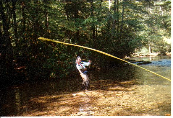
The Davidson River flows out of Pisgah National Forest, and runs along US276 to Brevard. Just upstream from the US276/NC280 junction is the Davidson River Campground, a nice USFS facility (even has hot showers, if the plumbing is working!). This is a busy campground, and reservations are a must in the summer.
The river from Brevard up to the west end of the campground is hatchery supported, and is heavily populated by tubers in the summer. However, at the edge of the campground at the conflux with Avery Creek, the Davidson becomes catch & release, flyfishing only.
This is an easily accessible river, and the fishing pressure can be heavy on weekends. Weekdays are fine, usually. It's a big stream as Southern Appalachian trout streams go, 15-20 yards wide until it reaches its fork just below Looking Glass Falls on US276. At the fork, one branch goes up to the Blue Ridge Parkway. This is regulated as "wild trout water". I've never fished this branch, which is called Looking Glass Creek. The other branch is still called the Davidson River, and flows up along a USFS road to Pisgah trout hatchery and beyond...
I like to fish the Davidson, primarily because my family likes the campground and I can easily squeeze in some fishing with family activities. I've caught fish, but never the big ones I *know* are in there (I've seen some big fish and read reliable reports of 20+" browns). The Davidson is is beautiful water, mixing riffles with deep, emerald pools. I've fished primarily the sections near the campground (withing walking distance) or the section from the branch with Looking Glass Creek up to the hatchery. I've had much better luck on the upper section below the hatchery. I've been told that the effluent from the hatchery enriches the stream in that section, promoting more insect life and thus more trout. Right now (this was written in the fall of 1994), there are a *lot* of fish right below the hatchery due to a flood in the summer (1994) that washed about half the stock into the stream. That's what I call a heavy stocking program :-)
There are several miles of C&R water here, and I'd like to spend a week really working it over. Give it a try!
Here's a nice report from Steve Sprinkle, reporting on a November 1996 trip...
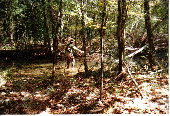
I had a great day fishing the Thompson River last Tuesday. I'll include directions and other info about the river below, but first I want to tell about the good stuff. Since it's hunting season Duke Power has opened up Musterground Road, located in their Bad Creek Project. The road is made of gravel and is poorly graded in places, but is passable if you have 4-wheel drive. I drove on the Musterground to get to the Thompson (about 35 minutes to go 5 miles), and then fished about 3/4 mile worth of the river on either side of the road. The water was crystal clear and cold (45 degrees F), and the day was overcast but warm for this time of year (about 60 degrees F). The fishing was great! I landed and released 6 fish, and hooked up several others that got away. As usual, I was perversely stubborn about restricting myself to dry flies, and I had my best luck with a parachute version of an Adams. I saw very little insect activity--several tiny (22 hook size) brown mayflies, and a large (10 hook size) solitary mustard colored mayfly. My best fish was a 12" brown. There is one place in the river where a garage-sized boulder sits in the middle of the stream, forming a deep, 3 ft wide channel between the boulder and a sheer rock embankment. There is no way to cast into the channel, so I decided to climb onto the boulder and "dapple" my Adams on the surface of the water. I've never tried dappling before, but I've read about it-- apparently dappling was a traditional way of fishing in the Smokies. Anyway, I had nothing but the leader dangling from my rod, and I simply skipped the fly on top of the water. Before I knew it a brown trout gulped it down. I didn't even set the hook--I just saw a flash and then felt my rod bend. As I scrambled off the boulder I let the line go slack a couple of times, but the brown was well hooked, and didn't escape. It was beautiful, and I kept it just long enough to take its picture. Anyway, if you don't mind dodging hunters, you might consider trying the Thompson out on balmy days this winter. It's a delightful, stair-step, Appalachian stream, and its full of trout.
Location: The Thompson is one of several rivers that flow into Lake Jocassee (others are the Whitewater, Bearcamp, Horsepasture, Bear, Cobb, and Laurel Fork). The lake and its rivers are in the NW corner of SC, right at the border of NC. The lake is formed by a dam, and much of the land around it is owned by Duke Power. The lake is full of trout, but there isn't much migration between the lake and its rivers because of the large falls that typically form near where the rivers flow into the lake.
Access: You can reach the Thompson from a bridge on NC 281 south of Cashiers, but that part of the river is heavily fished. The truly idyllic part of the river must be reached by boat from Lake Jocassee, by trail, or by a gravel road that is usually closed to traffic (more on that below). Duke Power Company supports the Foothills Trail, which runs about 45 miles along the SC/NC border, and crosses all of the rivers that flow into the Jocassee. This trail is my usual way of getting to the Thompson. Maps are available from several sources. A rough, schematic map (free) can be had from:
Duke Power Co.
Project Recreation
P.O. Box 33189
Charlotte, NC 28242
704-373-8032
A very detailed, pocket-sized book with topo maps can be had from:
Foothills Trail Conference
P.O. Box 3041
Greenville, SC 29602
(864) 467-9537
Many bookstores in the area also carry this book, called Guide to the Foothills Trail. If you are into the
topo maps from the U.S. Geological Survey, look up the Cashiers, NC-SC-GA and Reid, NC-SC 7.5 minute series (each
map was photorevised in the early 1990's). A map is also available at the gate of Duke Power's Bad Creek Project,
located on SC 130 just south of the NC border. (SC 130 and NC 281 are the same road.)
If you hike in, you will want to park at the Bad Creek Project. You don't need advance permission--you just sign in at the gate. >From the parking area you hike 4+ mi to the Thompson. It's a long ways. It takes me 2 hrs each way. It's a lot of trouble. But you are very likely to have the river to yourself, and some things are worth walking for. You will see a rough gravel road at the Bad Creek Parking Area called the Musterground. It is only open to regular traffic during hunting season. The road runs just south of the trail, closer to Lake Jocassee, and meanders more than the trail since it hugs the Lake. Once you get to the river by the trail, or the Musterground, or the lake, there is no trail running up and down the river. But I've made my way all the way from the lake up to and across the Musterground and beyond the Foothills trail by scrambling up waterfalls and wading through the river. I usually target a 1/2 mile strecth of river somewhere between the lake and the trail, and then fish away. .The fishing: look for rainbows and browns. The Thompson has been stocked from time to time with fingerlings, but the trout population does reproduce, and any catchable fish are essentially "wild." I have caught 8-12" fish in the fast, short, flat areas or the river, and have caught larger fish in the plunge pools that form at the larger falls. Anything over a 5 wt fly rod is probably too heavy. I'm partial to dries (ants, parachutes, etc.), but these opportunistic fish will hit just about anything that is presented w/ stealth and cunning. There isn't a lot of casting room--the river averages 15 or 18 ft in width--, but there is enough to get by.
I hope anyone who fishes the river will catch and release, since it would be easy for even just a few of us to deplete the trout population otherwise. .When to fish: the Thompson runs muddy after rains, and the fishing turns dismal. Spring and Fall are the best seasons, Summer is good early in the day or late. Balmy Winter days are also good.
Other thoughts: if you hike to the Thompson you will be sorely tempted to stop after the first 1/2 mile and fish the Whitewater. The Whitewater is larger (25-30 ft in width), and the access is much easier--thus, it is stocked more, receives more fishing pressure, and, to my mind, is less enjoyable. If you are into backpacking, you can make a wonderful trip of hiking the Foothills Trail and fishing the various rivers that flow into the Jocassee.
There is a designated, primitive camping site situated between the Whitewater and the Thompson that would make an ideal camp for anyone wanting to fish both rivers.
I'm happy to answer any questions you might have. If you are intriqued, give the river a try, and while you fish it, treat it well.
Return to  Joel's Home

This page is maintained by joel_dunn@unc.edu

Last updated 4-January-1999